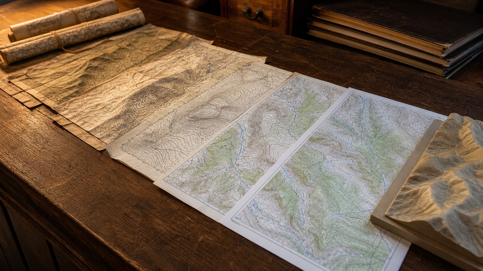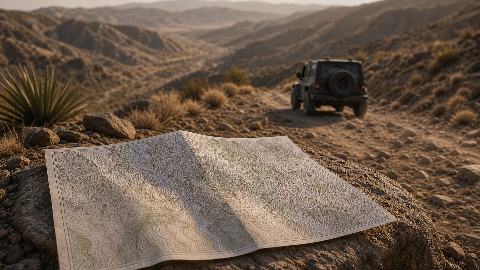
Land conservation begins with understanding. Before policies are written, before fences are installed, before restoration crews plant native grasses or rebuild wetlands, someone must study the land itself. That study often begins with a 2D topographic map. These detailed, contour-based maps transform hills, valleys, rivers, and ridgelines into readable patterns, allowing conservationists to interpret terrain in a way that is both scientific and intuitive. A 2D topographic map uses contour lines to represent elevation changes. Each line connects points of equal height above sea level, revealing the rise and fall of landscapes across forests, deserts, wetlands, and mountains. At first glance, it may look like a series of abstract lines, but for conservation professionals, those lines tell a powerful story about water flow, erosion risks, wildlife corridors, and habitat boundaries. They help answer critical questions: Where will water accumulate? Which slopes are vulnerable to runoff? Where can species migrate safely?
Elevation, Contours, and the Blueprint of Nature
Every landscape has structure. Mountains rise, valleys cradle rivers, plateaus stretch outward, and subtle depressions collect seasonal rainfall. 2D topographic maps translate these three-dimensional realities into clear, measurable information. Through contour spacing and elevation markers, conservation planners can visualize gradients, slope steepness, and terrain complexity without ever stepping foot on the ground.
Steep slopes, for example, are identified by tightly spaced contour lines. These areas are more prone to erosion, landslides, and rapid water runoff. Gentle slopes, represented by widely spaced lines, often provide safer ground for restoration projects or habitat preservation. By analyzing these patterns, conservationists determine which areas require immediate protection and which can sustain limited human interaction.
Elevation also plays a crucial ecological role. Temperature, vegetation types, and wildlife distributions often shift with altitude. In mountainous regions like the Rocky Mountains, elevation differences of just a few hundred feet can dramatically alter plant communities and animal habitats. A 2D topographic map allows researchers to anticipate these transitions and design conservation zones that reflect natural ecological boundaries rather than arbitrary political lines.
In this way, topographic maps function as blueprints of nature. They show not just where the land is, but how it behaves.
Water Flow, Watersheds, and Protecting Critical Resources
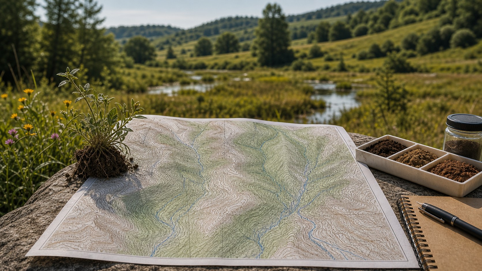
Water is the lifeblood of ecosystems, and 2D topographic maps are essential for understanding how it moves. Contour lines reveal drainage patterns, watershed boundaries, and the direction of stream flow. By studying these details, conservation planners can protect water resources before they become polluted or depleted.
Watershed conservation depends on identifying high points and low points. Ridge lines mark divides between drainage basins, while valleys and depressions signal areas where water accumulates. In major river systems such as the Mississippi River, understanding upstream terrain is critical for downstream flood prevention, water quality management, and wetland protection.
2D topographic maps allow conservationists to predict how rainfall will travel across a landscape. This is particularly important in areas vulnerable to flooding or erosion. If development occurs without considering slope and drainage patterns, runoff can accelerate, carrying sediment and pollutants into streams. With topographic analysis, planners can design buffer zones, protect riparian corridors, and implement erosion-control strategies that align with natural water flow.
Wetland conservation also relies heavily on elevation data. Even minor elevation changes determine whether an area remains seasonally flooded or dries out completely. By examining contour lines, conservation teams can identify potential wetland restoration sites and prevent infrastructure from disrupting delicate hydrological balances.
Ultimately, protecting water resources begins with understanding the land’s contours.
Habitat Preservation and Wildlife Corridors
Wildlife does not recognize property boundaries or city limits. Animals move along terrain features that offer safety, food, and shelter. Ridges, valleys, riverbanks, and forested slopes often serve as natural migration routes. 2D topographic maps help conservationists identify and preserve these critical corridors.
Elevation influences temperature and vegetation, which in turn affects species distribution. In highland ecosystems, cooler temperatures support specific plant communities that certain animals depend on. In lowland valleys, water access and fertile soils create entirely different habitats. Mapping these variations allows planners to connect fragmented habitats through strategically protected zones.
In large protected areas such as Yellowstone National Park, wildlife corridors extend beyond park boundaries. Topographic maps help regional planners coordinate conservation efforts across public and private lands. By analyzing slope gradients and elevation changes, they can anticipate how animals like elk, wolves, and bears traverse the landscape seasonally.
This is particularly important as climate change shifts suitable habitat zones. Species may migrate upslope in search of cooler temperatures. Without careful conservation planning informed by topographic data, development could block these natural escape routes.
Through careful interpretation of 2D topographic maps, conservationists design protected areas that mirror the natural movement patterns of wildlife rather than imposing artificial constraints.
Guiding Sustainable Land Use and Development
Land conservation does not always mean eliminating human presence. Often, it means guiding development in a way that minimizes environmental impact. 2D topographic maps are invaluable for balancing growth with ecological stewardship.
When planners evaluate potential development sites, slope analysis is a primary consideration. Building on steep terrain increases construction costs and environmental risks. Soil instability, increased runoff, and habitat disruption are common consequences. Topographic maps highlight these risks early in the planning process, steering projects toward more sustainable locations.
In coastal regions and river valleys, elevation data also helps identify flood-prone areas. Conservation policies frequently rely on topographic analysis to establish setback requirements and restrict construction within vulnerable zones. This proactive approach not only protects ecosystems but also reduces long-term infrastructure damage.
Agricultural land management benefits as well. Farmers use topographic information to design contour plowing strategies that reduce soil erosion. By aligning agricultural practices with natural land contours, soil health improves and water retention increases. Conservation easements often incorporate topographic data to define boundaries that reflect natural land features rather than arbitrary survey lines.
Through these applications, 2D topographic maps support a model of conservation that integrates human activity without compromising ecological integrity.
Supporting Climate Resilience and Adaptive Strategies
As global temperatures rise and weather patterns become more unpredictable, land conservation must adapt. 2D topographic maps play a critical role in climate resilience planning.
Elevation data helps identify areas at risk from sea-level rise, particularly in coastal communities. Subtle differences in height can determine whether land remains dry or becomes permanently inundated. Conservationists use topographic maps to prioritize the protection of higher ground that can serve as future habitat refuges.
In mountainous regions, snowpack patterns and glacial melt influence downstream water supplies. By studying terrain features, researchers can model how warming temperatures will alter runoff timing and volume. These insights guide water conservation strategies and habitat restoration efforts.
Wildfire management also depends on terrain analysis. Slope steepness affects fire behavior, with flames spreading more rapidly uphill. Topographic maps allow land managers to identify firebreak locations and high-risk zones. In ecosystems similar to those found in Sierra Nevada, elevation and aspect determine vegetation density and dryness, influencing wildfire patterns.
By integrating topographic data into climate models, conservation professionals create adaptive strategies that anticipate change rather than reacting to disaster.
From Paper Maps to Digital Precision
While traditional paper topographic maps remain valuable, modern conservation increasingly relies on digital mapping technologies. Geographic Information Systems, or Geographic Information System technology, integrates 2D topographic data with satellite imagery, land use records, and climate projections. This layered approach enhances precision and predictive power.
Digital elevation models allow conservationists to simulate water flow, erosion patterns, and habitat shifts under various scenarios. What happens if rainfall increases by 20 percent? How will a new road alter drainage patterns? These questions can be tested virtually before real-world consequences unfold.
Despite technological advances, the fundamental principles remain grounded in 2D topographic mapping. Contour lines, elevation gradients, and slope calculations still form the basis of digital analysis. The difference lies in speed and scale. What once required hours of manual measurement can now be analyzed across entire regions in minutes.
By combining traditional cartographic principles with advanced software, conservationists gain both clarity and efficiency. The core idea remains unchanged: understanding the shape of the land is essential to protecting it.
A Timeless Tool for a Sustainable Future
At its heart, land conservation is about foresight. It requires seeing not only what the landscape is today but what it could become tomorrow. 2D topographic maps provide that vision. They reveal hidden relationships between elevation, water, soil, vegetation, and wildlife. They transform abstract environmental concerns into tangible, measurable realities. In an era defined by rapid development and environmental uncertainty, these maps serve as anchors of informed decision-making. They guide restoration projects, shape protected areas, prevent costly environmental mistakes, and strengthen climate resilience. From the slopes of the Appalachian Mountains to coastal wetlands and arid plains, topographic mapping continues to influence how land is preserved and managed. The beauty of a 2D topographic map lies in its simplicity. A series of lines, carefully drawn, carries within it the story of an entire ecosystem. When conservationists learn to read those lines, they gain the ability to protect landscapes not just for today, but for centuries to come. In this quiet yet powerful way, 2D topographic maps remain one of the most essential tools in land conservation. They remind us that the land has structure, patterns, and rhythms. And when we take the time to understand those patterns, we become better stewards of the natural world.